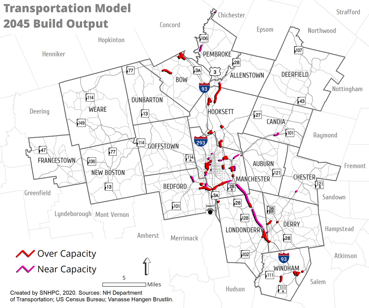
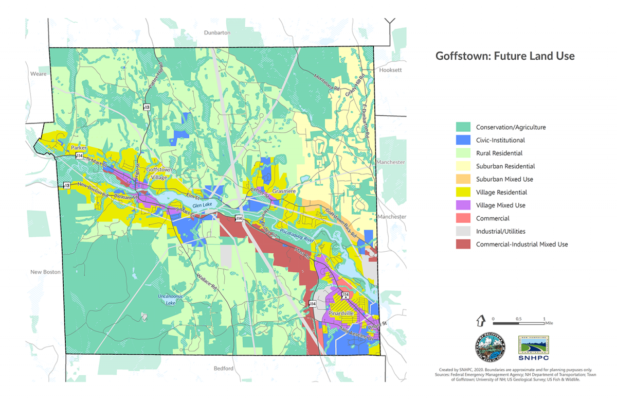
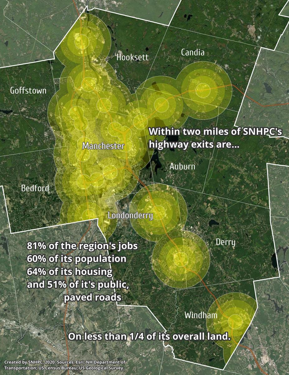
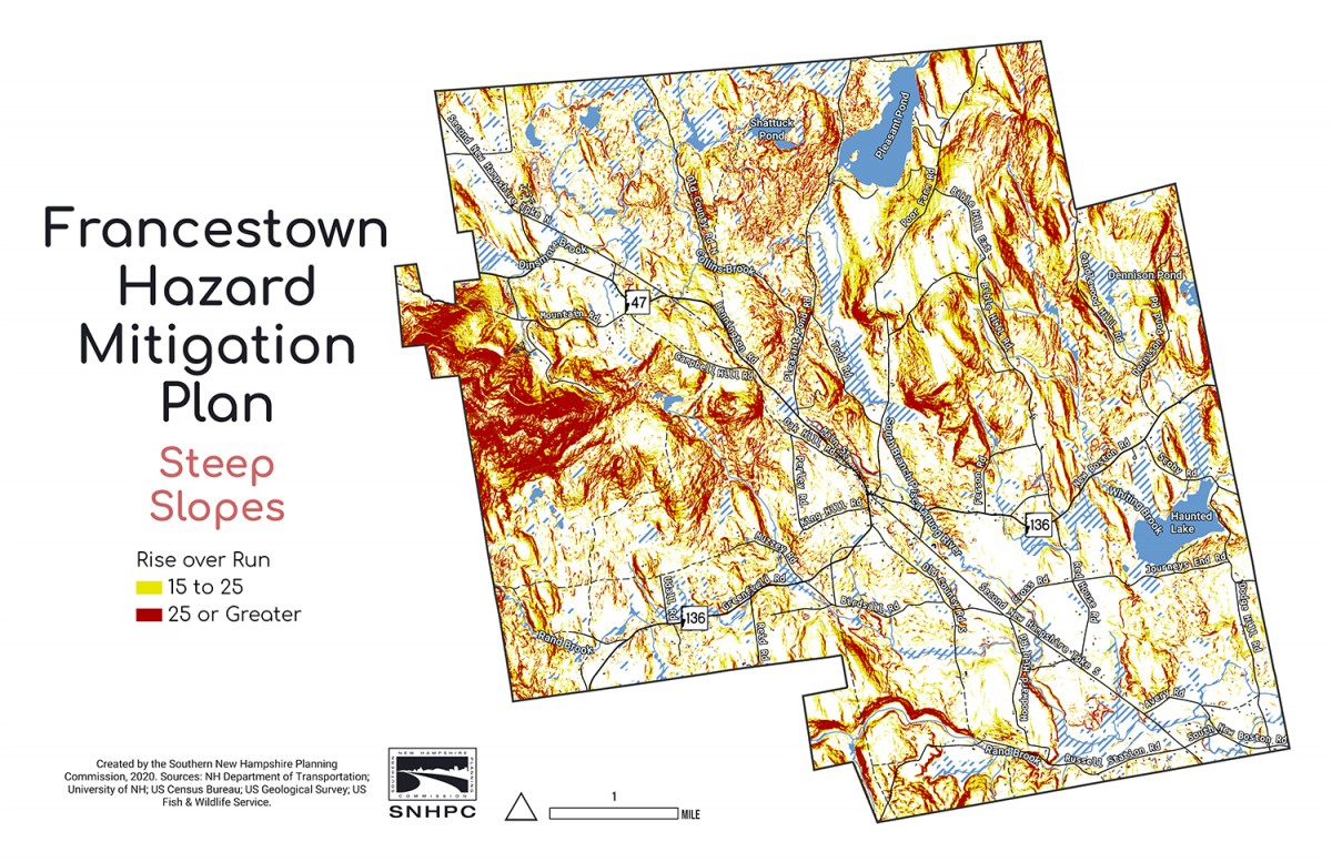
Map Gallery

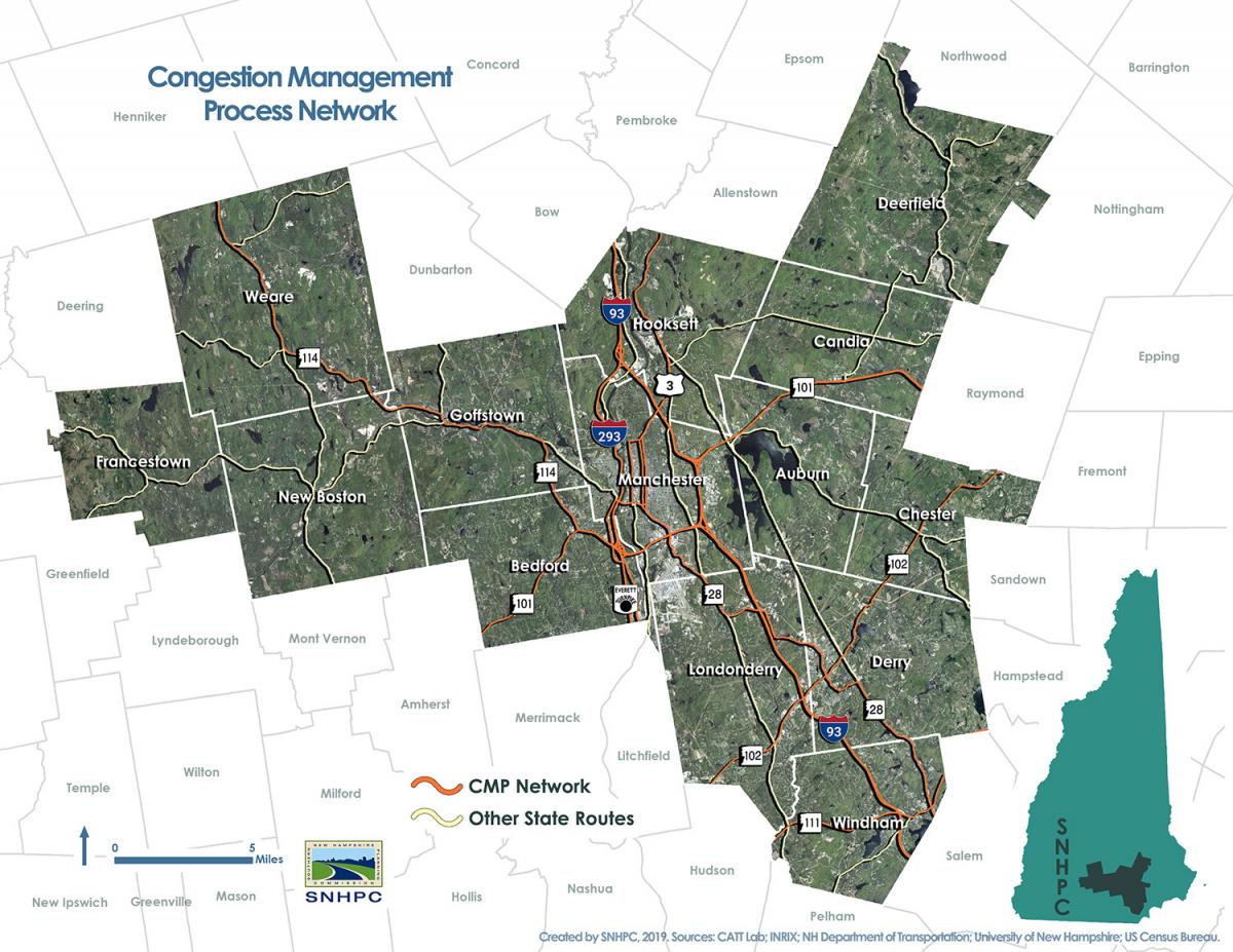
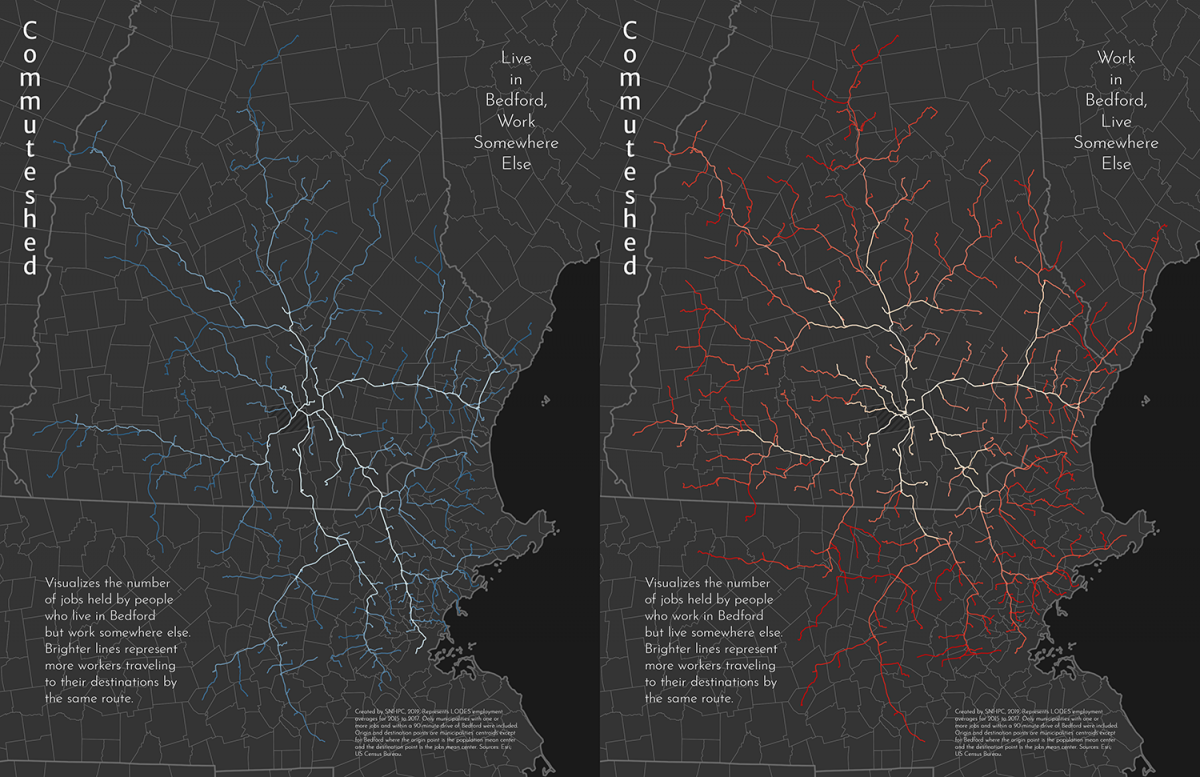
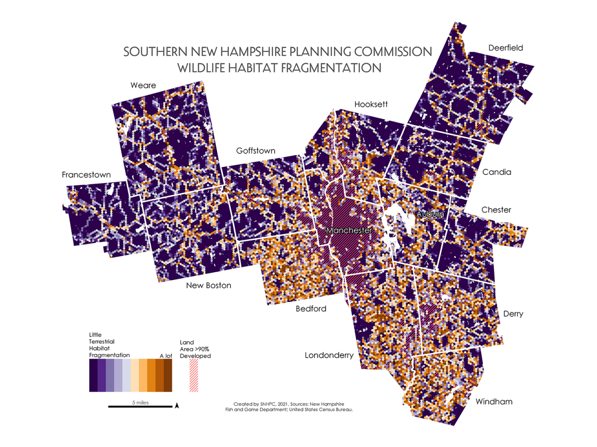
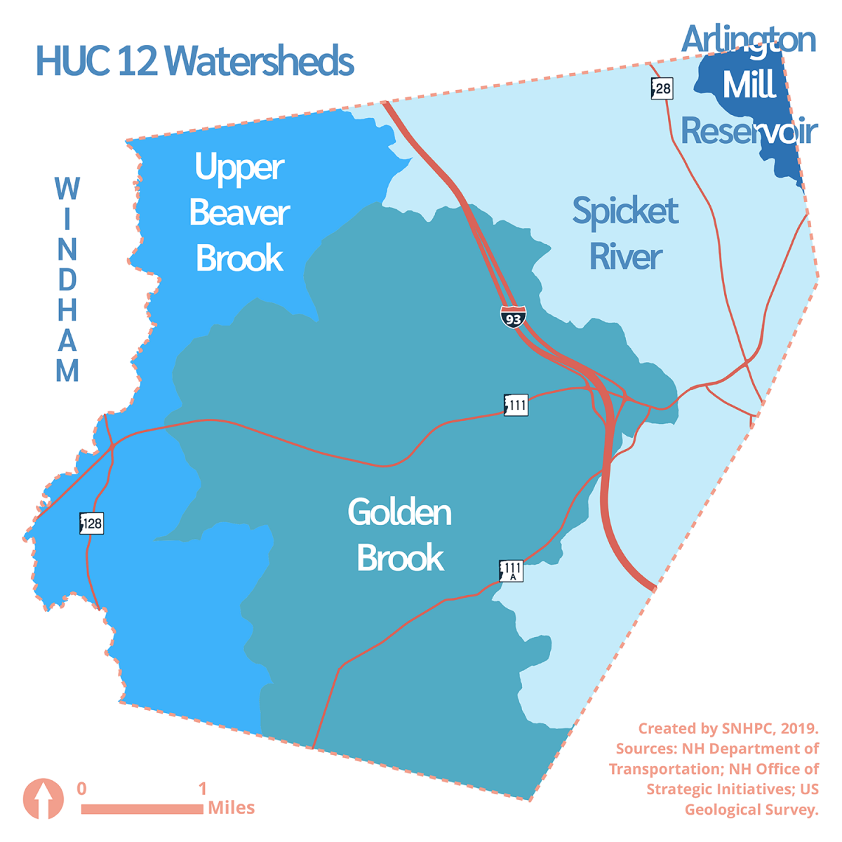
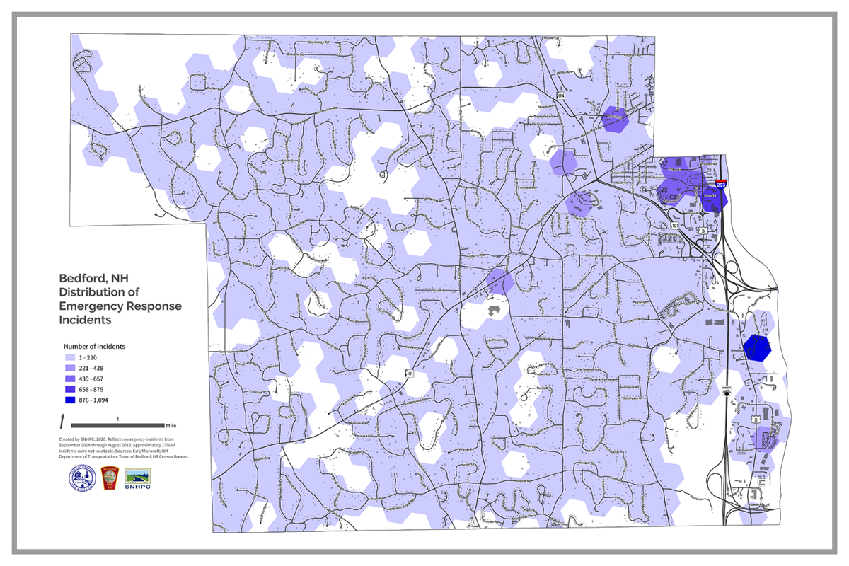
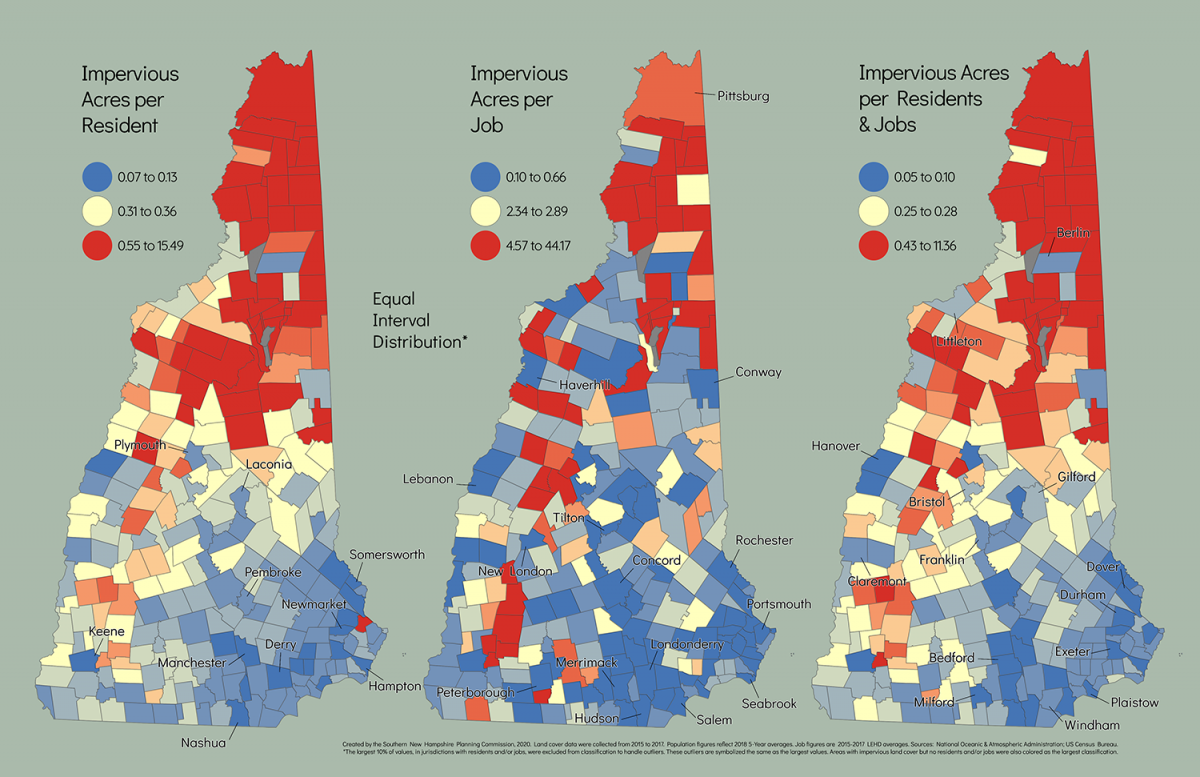
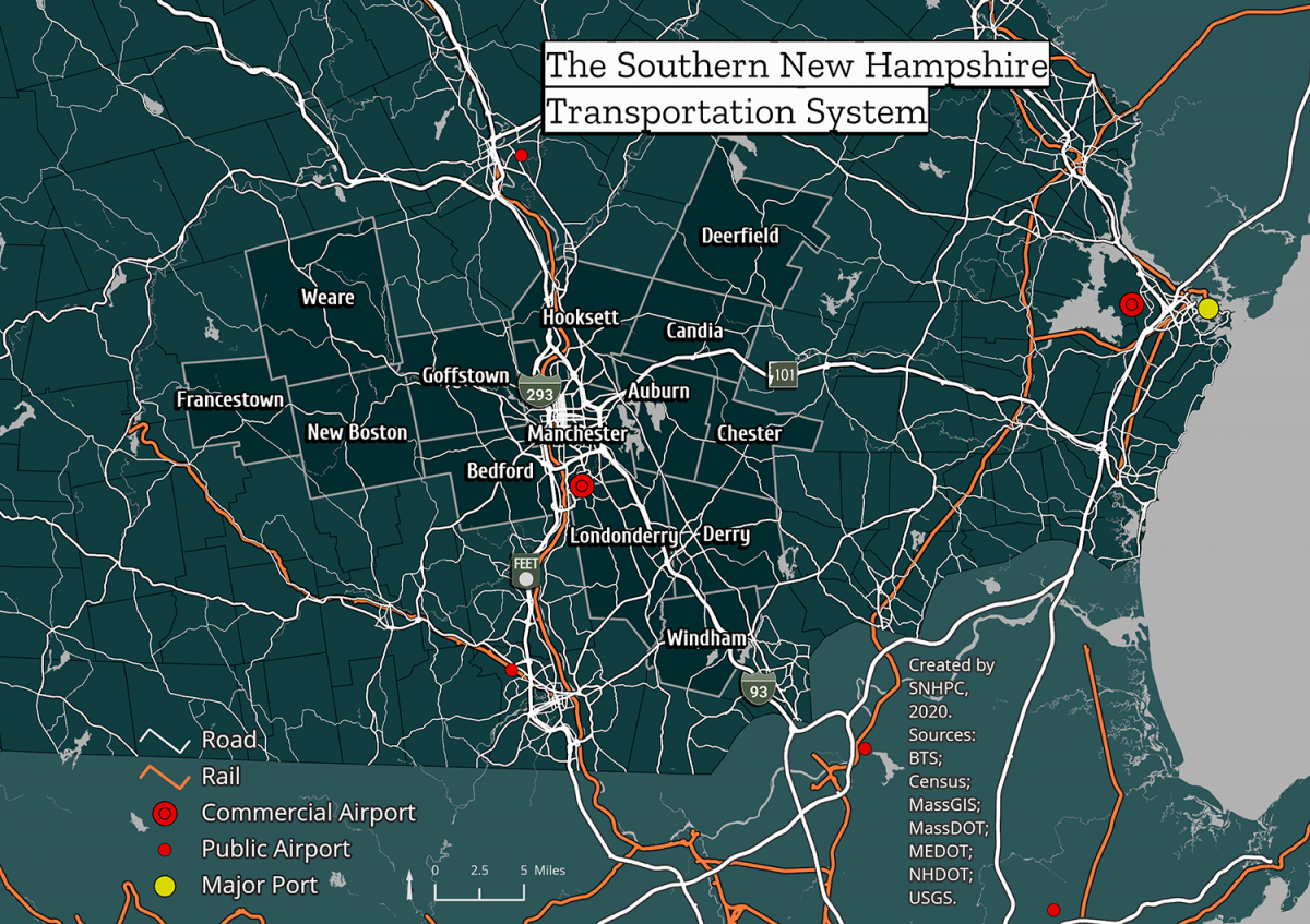
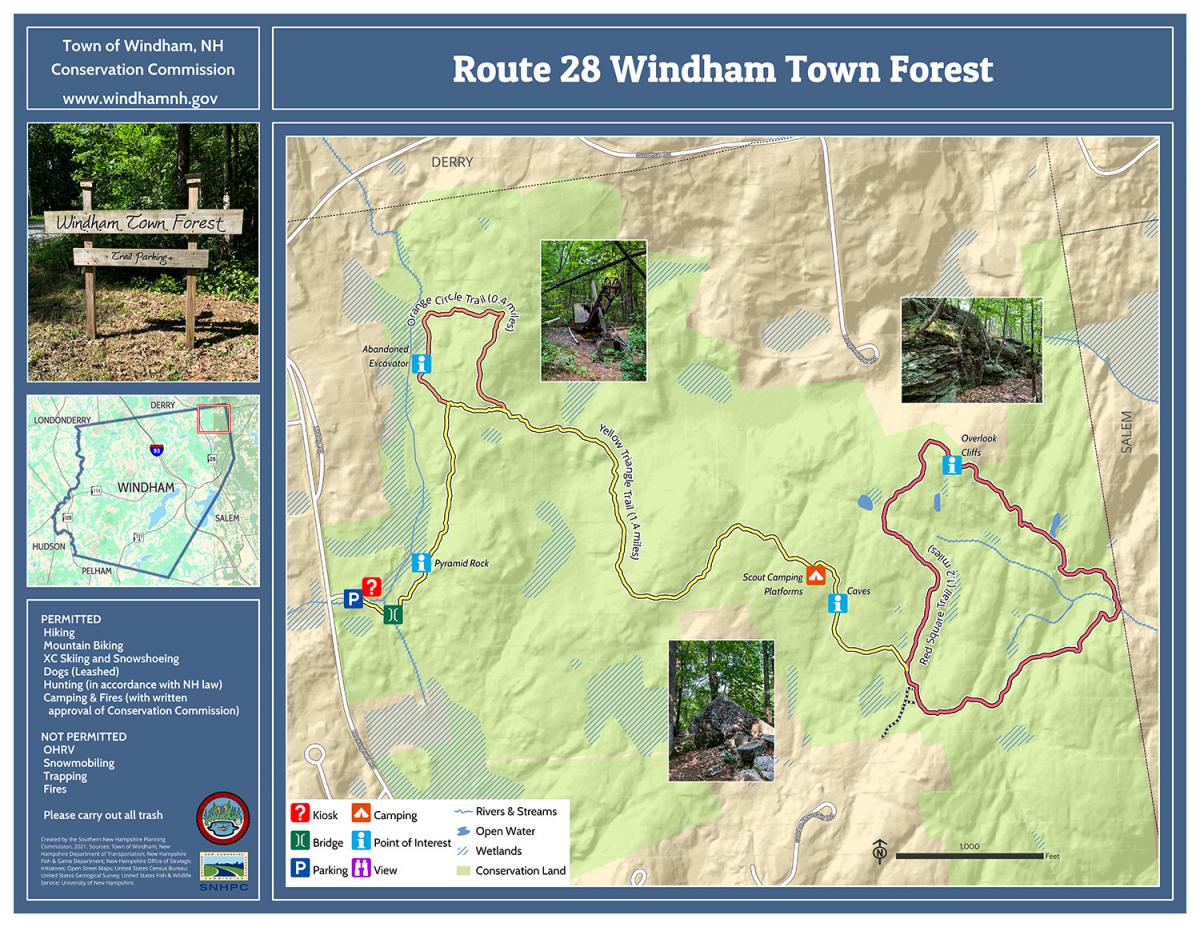
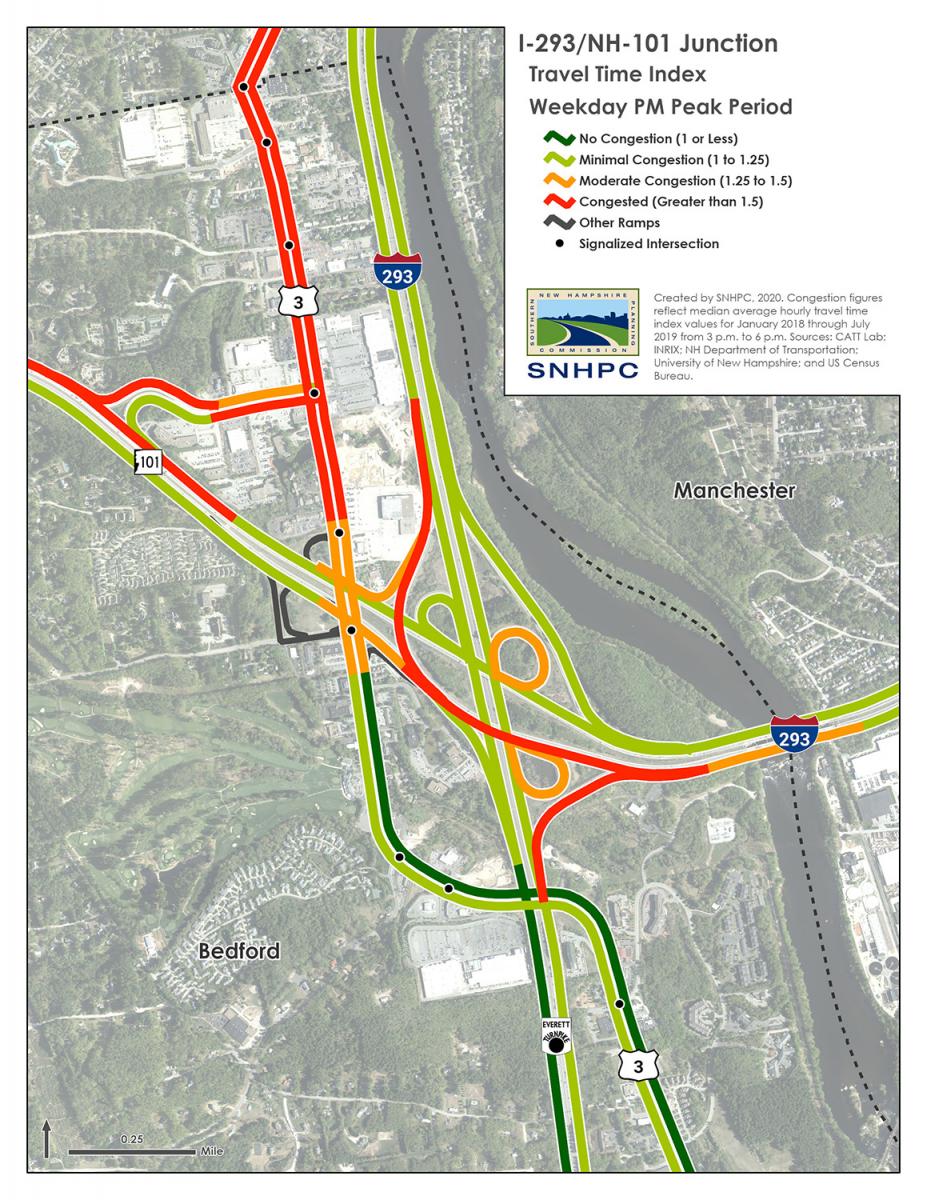
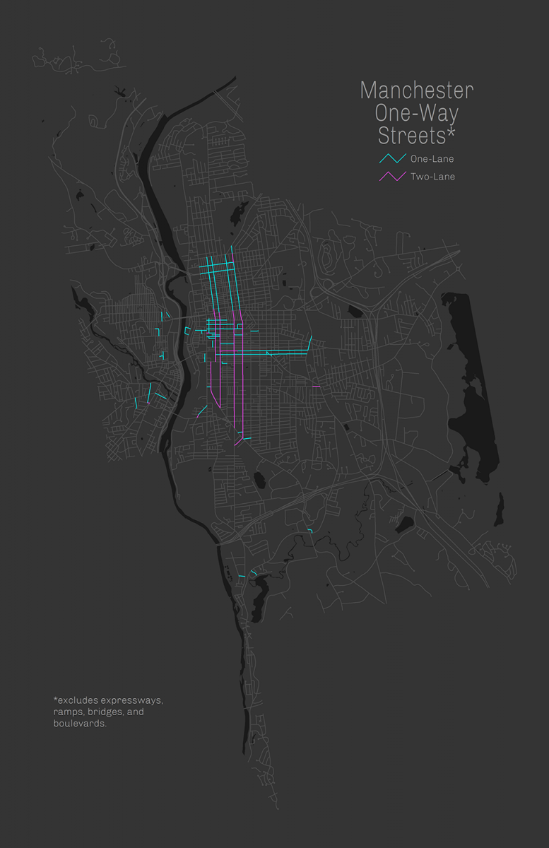
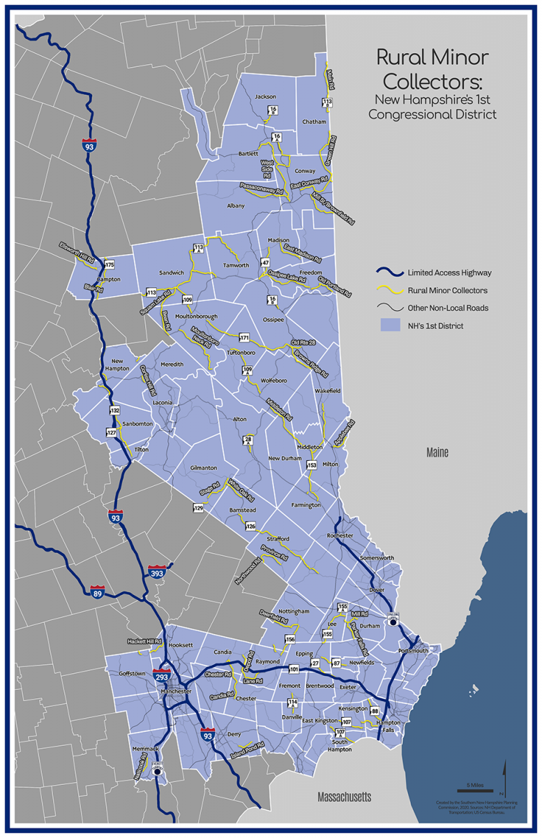
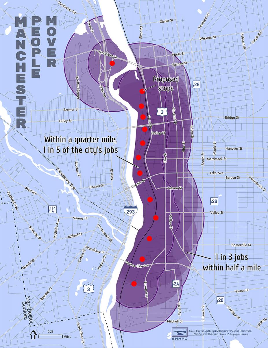
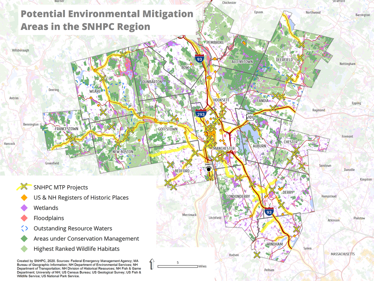
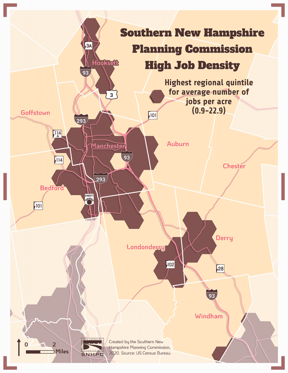
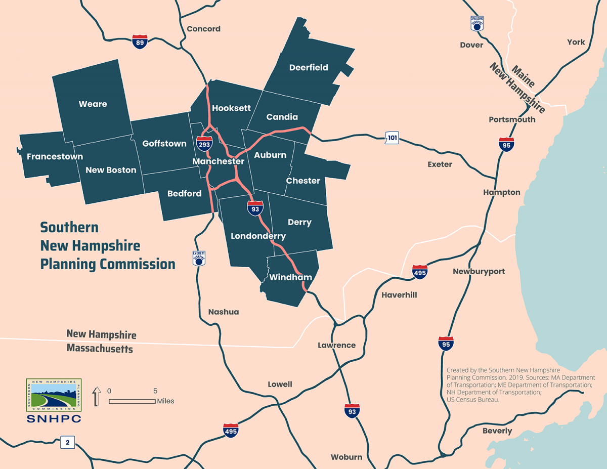
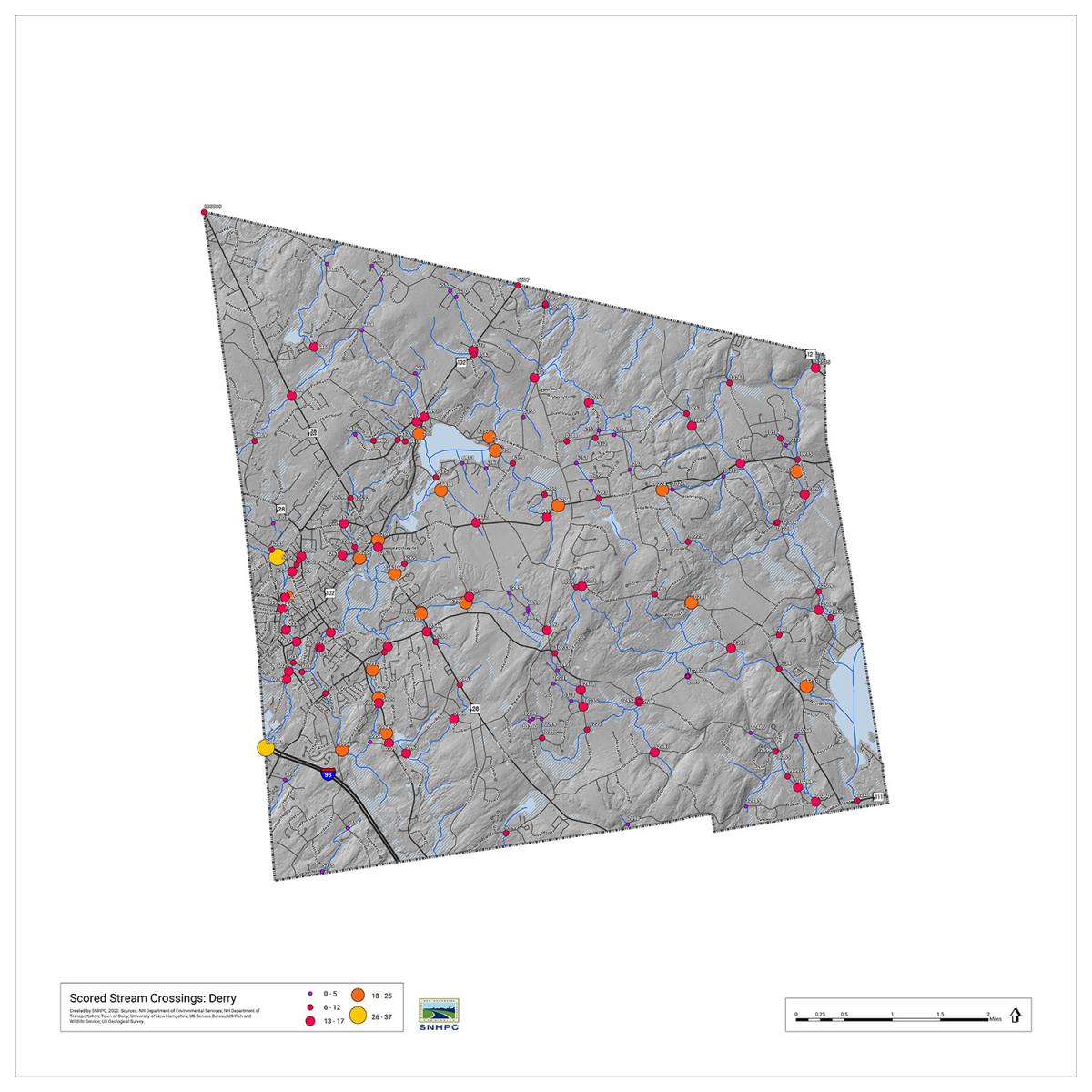
SNHPC produces many maps for a variety of different planning purposes—from forecasting land uses to analyzing commuting patterns. Here are some example maps from recent work.

SNHPC Congestion Management Process network map

Bedford commutershed

Map of the SNHPC region showing wildlife habitat fragmentationWindham HUC 12 watersheds map


Evening travel time index map for the I-293/NH-101/Everett Turnpike junction

Map of the One-way streets in Manchester

Map of NH Congressional District 1 minor collector roads

Manchester people mover stop map


2045 Metropolitan Transportation Plan projects build scenario road efficiencies

Goffstown future land use mapMap showing the proximity of jobs to limited access highway exits

Francestown map of steep slopes

Bedford map of emergency incidents

Map of analysis of NH county subdivisions by impervious acres per resident and job

Regional transportation network map for SNHPC

Rt 28 Windham Town Forest trails map

SNHPC 2021 Metropolitan Transportation Plan projects and constraints

SNHPC high density job areas map

SNHPC region mapVulnerability scoring of stream crossings in Derry