
Statewide Asset Data Exchange System (SADES)
The Statewide Asset Data Exchange System (SADES) utilizes modern technology to collect data on transportation-related community assets. Data is collected using ESRI (a geographic information system company) software, ArcDesktop and ArcOnline, which allows anyone with a smart phone or tablet to have access to the asset management database. At SNHPC, data is collected using the ESRI Collector application on an iPad. After the user inputs the data into the app, it is instantly submitted, or uploaded, to the server on the cloud where it remains and can be accessed anytime and from anywhere for analysis purposes.
Data can be collected on the following assets:
- Stream crossings
- Pedestrian Facilities (sidewalks, crosswalks, curb ramps)
- Goffstown report (2024)
- Road Surface Management System (RSMS)
- Guard rails
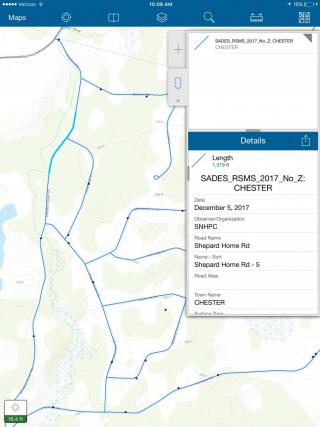
In 2017-18 SNHPC worked with the Town of Chester to conduct a road inventory data collection, identification of pavement conditions, and operation of the statewide Road Surface Management System (SRSMS) software. This is part of the program being used by the NH Department of Transportation (DOT), in partnership with UNH T2 and the regional planning commissions, to assist communities in planning local road maintenance. The complete report for the road inventory, condition assessment, and forecasting for Chester can be found below:
In 2019-20, SNHPC worked with the Town of Deerfield to conduct a similar assessment: